Agriculture - Forestry - Fishery
|
|
Evaluate the separate ability of mangrove forests from the vegetation cover of Sentinel-2 at Lap An Lagoon, Thua Thien-Hue Province.
|
|
|
The study was conducted by Ha Nam Thang, Le Van Dan and Le Thi Ngoc Tu.
|
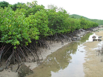
Photo illustration.
Mangrove forests provide many important ecosystem services to nature and to human life. In the context of global warming and increasing human economic activity, the observation of the changing distribution of mangrove forests on space and time have high urgency.
The study used a new satellite image source, which was distributed free of charge at high spatial resolution. A scene of Sentienl 2 was taken on 13/02/2016 covers the study area used at the 2A treatment level. Two indicators: Simple Ratio and Chlorophyll Index were applied to supplement the new spectrum, support the thin mangrove forest distribution with small area in Lap An lagoon.
The results show that the Sentinel - Sentinel – 2 image is well suited for distribution mapping and monitoring mangrove forest variation. The Chlorophyll Index measures predict the best mangrove forest distribution with the general accuracy of 88.07%, the producer accuracy reaches 79.81% for mangrove forest and the coefficient Kappa reaches 0.816. The estimated mangrove area from the Chlorophyll Index supplemental image is 17.68 ha, increase compared with previous studies. |
ttncac
Follow Journal of agriculture and rural develpment |