Agriculture - Forestry - Fishery
|
|
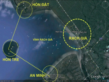
Studying flow morphology changes before and after construction of sea dikes of Rach Gia - Kien Giang
|
|
|
In order to actively respond to climate change and rising sea level, taking and exploiting advantages of marine resources to accelerate regional economic - social development speed, Ministry of Technology and Technology assigned Southern Irrigation Science Research Institute to implement this project.
|
Photo illustration
The calculation results of the sediment regime and flow changes of Rach Gia sea showed the central bay, including before and after having sea dikes, accretion trend prevails; sedimentation rate is around 5-10 mm / year without dikes and 5-12 mm when it has dikes; Bay’ topography fluctuations occur primarily in the reservoir (the dike), while the outer dike is negligible. Erosion in the drain construction sector regulators sizable, length of upstream and downstream erosion is approximate to 1.5-2 times of sewer drain width and erosion rate is around 24-28 cm / year. Therefore, designed works should have the power reinforcing solutions to prevent appropriate erosion. Scenario forecasts simple morphology volatilities, only for the problem in the current situation, not to account for rising sea level, flow changes in the river and sediment reduction (by the hydraulic power dam will be built on Mekong river), so the morphology changes of the study area may be different compared to the calculation results. This issue requires further studies. |
ntctu
Follow Joutnal of Argriculture and Rural development (No 2, 2015) |